Few countries reward the open road like New Zealand. Beyond the cities, public transport thins out fast, and much of what makes these islands extraordinary, glacier-carved valleys, volcanic plateaux, coastlines shredded by Tasman swells, lies between destinations rather than at them. A road trip here is not just the best way to travel; for large stretches of the country, it is the only way.
What follows are seven of the finest routes across both the North Island (Te Ika-a-Maui) and the South Island (Te Waipounamu), covering everything from two-hour adrenaline shots to multi-day epics through genuinely remote terrain. Between them, they take in fjords, vineyards, volcanoes, whale-watching coastline and at least one self-declared republic.
With that in mind, here are New Zealand’s 7 greatest road trips.
Queenstown To Wanaka Via The Crown Range
Distance: 70km | Time: 1 hour
Let’s ease you in gently…
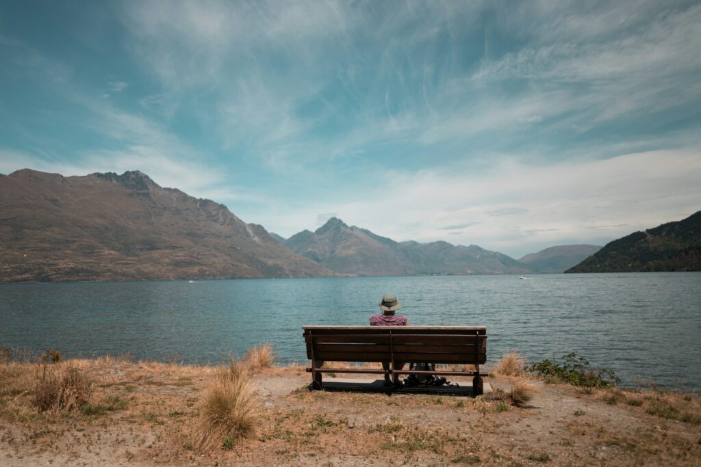
New Zealand’s highest sealed road climbs to 1,121 metres between two of the South Island’s most popular resort towns, and while it is short enough to drive before lunch, the views from the summit, out across Lake Wakatipu and the Wanaka basin to the snow-capped Harris Mountains, demand repeated stops.
The ascent from the Queenstown side passes beneath the tussock-covered slopes of Coronet Peak before the road rears upward through a series of tight switchbacks, the kind of driving that rewards patience and a pulled handbrake at every viewpoint.

The descent through the Cardrona Valley passes the historic Cardrona Hotel, a gold-rush-era pub that remains in operation, and some of Central Otago’s best vineyard country. In winter, chains are mandatory, and the road regularly closes in heavy snow. In summer, the tussock-covered tops glow gold in late afternoon light, and the whole drive takes on an almost cinematic quality, unsurprisingly, given how much of the Lord of the Rings trilogy was filmed in this corridor.
Read: The world’s best heli-skiing destinations
Te Anau To Milford Sound (The Milford Road)
Distance: 119km | Time: 2 hours driving, 4+ hours with stops
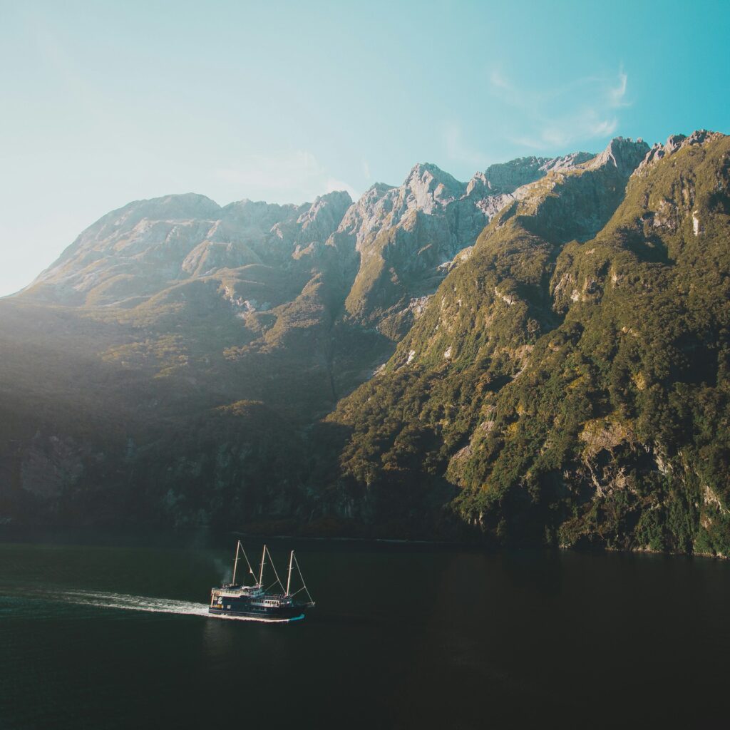
Widely considered the single greatest drive in the country, State Highway 94 from Te Anau to Milford Sound climbs through Fiordland National Park and the Te Wahipounamu World Heritage Area, passing through landscapes that shift from gentle farmland to dense beech forest to the vast, glacier-flattened floor of the Eglinton Valley within the first hour.
Stop at Mirror Lakes for reflections of the surrounding peaks on a still morning, then push on toward the Homer Tunnel, a 1,270-metre passage hewn from solid granite over nearly 20 years of construction. Emerging on the far side into the Cleddau Valley feels like entering another climate zone entirely, with waterfalls streaming down every cliff face. The Chasm, a 20-minute forest walk just before Milford, is the final exclamation mark before the road ends at the fjord itself, where Mitre Peak rises 1,692 metres from the water.


There are no shops, no petrol stations and often no phone signal between Te Anau and Milford. Fill up before you leave, carry chains in winter and allow far longer than the distance suggests. This is a road that punishes anyone in a hurry.
Christchurch To Greymouth Via Arthur’s Pass (The Great Alpine Highway)
Distance: 241km | Time: 3 to 4 hours
The Great Alpine Highway crosses the spine of the Southern Alps, climbing over 900 metres through Arthur’s Pass National Park before dropping to the wild, rainforest-fringed West Coast. The landscape changes with extraordinary speed: Canterbury’s braided rivers and flat farmland give way to alpine scrub, sheer gorges and the Devil’s Punchbowl Falls, a 131-metre cascade accessible via a short track from Arthur’s Pass Village, one of the highest settlements in the country. Keep an eye out for kea, the world’s only alpine parrot, which patrol the car parks here with considerable self-assurance.

The descent to Greymouth passes through some of the densest native bush on the South Island, and Hokitika, a short detour south, is worth the diversion for its pounamu (greenstone) workshops and wild, driftwood-strewn beach. For travellers picking up a campervan from Travellers Autobarn’s Christchurch branch, this route makes for a spectacular first day on the road, with the depot sitting close to the State Highway for an easy launch westward.
Read: 7 tips for New Zealand first timers
Kaikoura To Blenheim (The Coastal & Wine Route)
Distance: 130km | Time: 2 hours
Heading north from Kaikoura along State Highway 1, the road hugs the coast beneath the seaward Kaikoura Ranges, passing rocky platforms where New Zealand fur seals haul out in colonies. Kaikoura itself is one of the few places in the world where sperm whales feed close enough to shore for year-round watching, and it is also the country’s foremost crayfish town. You will see roadside caravans selling fresh tails south of town.


The road swings inland after Seddon and drops into the broad, sun-drenched Wairau Valley, heart of the Marlborough wine region. This is where New Zealand’s global reputation for sauvignon blanc was built, and there are more than 150 producers within a short radius of Blenheim. Cellar door visits and vineyard lunches are straightforward to arrange without booking, though the better-known estates get busy in summer.
The Catlins (Invercargill To Dunedin Via The Southern Scenic Route)
Distance: 270km | Time: Allow 2 to 3 days
The Catlins coast, running between Invercargill and Dunedin along New Zealand’s rugged southern edge, is one of the least-visited stretches of the South Island and among the most rewarding. The road winds through podocarp forest and windswept farmland to reach a succession of wild, often deserted beaches, waterfalls and geological oddities.
Nugget Point Lighthouse, perched on a craggy headland above a chain of rocky islets, is one of the most photographed spots in the deep south. Cathedral Caves, accessible only at low tide, have twin 200-metre passages that rival the North Island’s Cathedral Cove for drama. McLean Falls crashes 22 metres through native bush, and at Curio Bay you can walk across a 180-million-year-old petrified forest at low tide, then return at dusk to watch yellow-eyed penguins waddle ashore. At Slope Point, the southernmost tip of the South Island, the wind-warped trees tell you everything about the latitude.
This is campervan territory. Freedom camping spots are plentiful (self-contained vehicles only), and the pace of the Catlins resists rushing.
The Forgotten World Highway (Stratford To Taumarunui)
Distance: 150km | Time: 3 hours driving, full day with stops
Switching to the North Island, State Highway 43 is New Zealand’s oldest heritage trail and one of its most atmospheric drives. Nicknamed the Forgotten World Highway, it crosses four saddles, threads through the single-lane Moki Tunnel (nicknamed the Hobbit’s Hole) and follows the Tangarakau Gorge, where cliffs rise to 500 metres on either side of what was, until its final section was sealed in February 2025, the last unsealed stretch of state highway in the country.
The centrepiece is Whangamomona, a village that declared independence from New Zealand in 1989 after being redistricted, elected a succession of presidents (including a goat) and still stamps novelty passports at the pub. Republic Day celebrations, held every two years, involve gumboot-throwing, possum-skinning and a Wild West shootout. The most recent addition to the highway is a series of three-metre-high sculptures installed in 2025 by Maori artists from Ngati Maru, Ngati Haua and Ngati Ruanui, telling the story of the explorer Tamatea-Pokai-Whenua.
There are no petrol stations between Stratford and Taumarunui, so fill up before you set off. A detour along Moki Road leads to Mount Damper Falls, the North Island’s second-highest waterfall.
Christchurch To Aoraki/Mount Cook
Distance: 330km | Time: 4 hours
Heading southwest from Christchurch through the Canterbury Plains, this route builds slowly. Flat farmland gives way to the foothills before Lake Tekapo appears, its water an otherworldly shade of turquoise caused by glacial rock flour suspended in the melt.
The Church of the Good Shepherd, a tiny stone chapel on the lakeshore, is one of the most recognisable landmarks on the South Island. At night, Tekapo’s status as part of the Aoraki Mackenzie International Dark Sky Reserve makes it one of the finest stargazing locations in the Southern Hemisphere.


From Tekapo, the road follows the western shore of Lake Pukaki, equally turquoise and equally improbable, toward Aoraki/Mount Cook National Park. New Zealand’s highest peak at 3,724 metres dominates the skyline for the final 30 kilometres of the drive. The Hooker Valley Track, the park’s most popular walk, is currently undergoing repairs following a bridge washout and is expected to fully reopen in autumn 2026; in the meantime, the Tasman Glacier View Track offers a shorter but still impressive alternative.
Planning Your Road Trip
New Zealand drives on the left. Roads are well-maintained but often narrow and winding, particularly on the South Island’s mountain passes and West Coast, so journey times can be significantly longer than the distance suggests. The speed limit on the open road is 100km/h, though on many of these routes, maintaining that consistently would be both impossible and inadvisable.
Campervans remain the most popular way to road trip the country, combining transport and accommodation in a single package and opening up access to New Zealand’s extensive network of Department of Conservation campsites and freedom camping spots (a self-contained vehicle is essential for freedom camping). International flights arrive primarily into Auckland on the North Island and Christchurch on the South Island, with Christchurch often the cheaper and more convenient starting point for South Island itineraries.

The summer months (December to February) bring the best weather and the busiest roads. March and April offer a sweet spot of settled autumn conditions, fewer crowds and golden light across the Southern Alps. Winter driving (June to August) requires chains on many mountain routes and brings road closures, but also dramatic snow-capped scenery and far greater solitude.
The Bottom Line
New Zealand’s landscape demands to be driven through rather than flown over, and the variety packed into these two relatively small islands is extraordinary. Whether you are crossing the Southern Alps in a morning or spending a week tracking the empty Catlins coast, the best moments tend to come between planned stops: a river valley you had not expected, a seal colony on a roadside rock, a mountain pass that opens up views in every direction. Plan loosely, leave early and take the longer route.


